Real data first
Roads, paths, car parks, the river and the railway come from OpenStreetMap. Building outlines come from OpenStreetMap and Ordnance Survey open data, which covers the housing estates OpenStreetMap is missing.
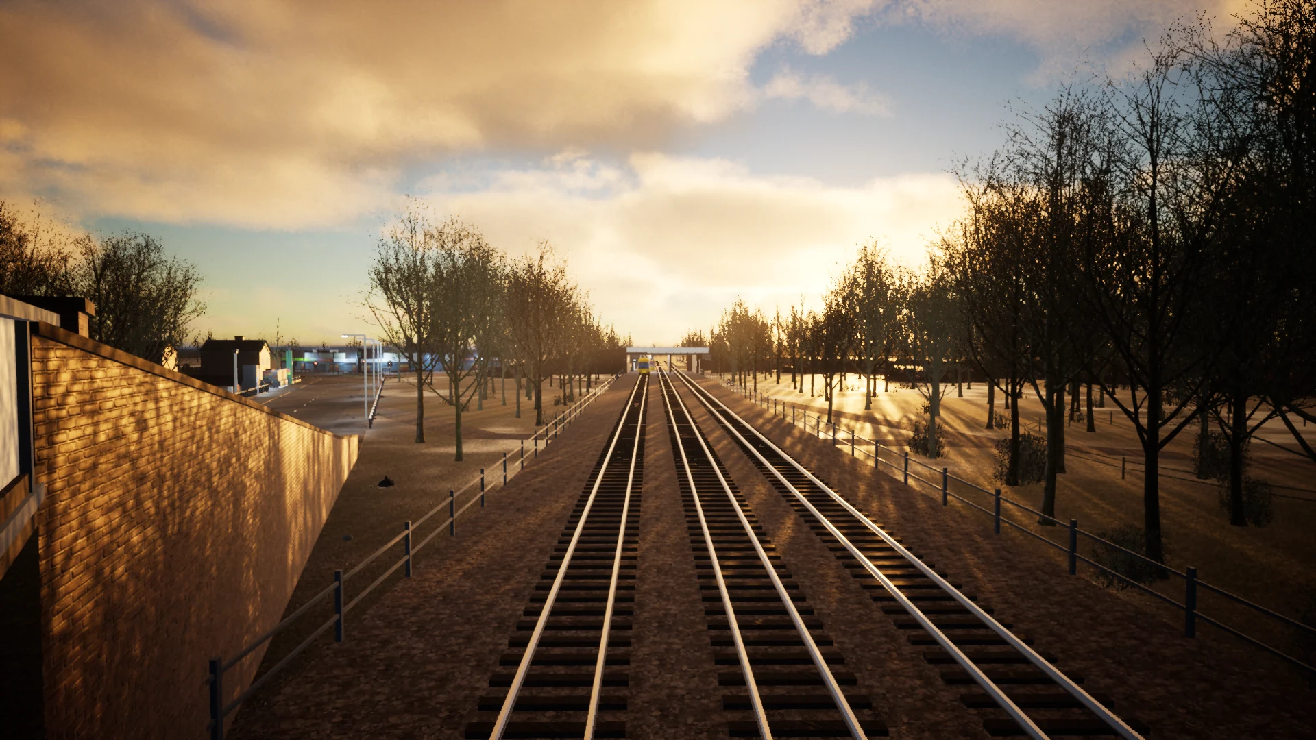
THE DEVELOPMENT STORY
One independent developer in Doncaster, building a whole town in Unreal Engine 5 with open map data, automation and AI-assisted tools.
DONCASTER ROAD BRIDGE / ACTUAL IN-ENGINE CAPTURE · WORK IN PROGRESS
01 / THE STORY
Kellian: After the AI Takeover is made by a solo, independent developer based in Doncaster.
It's built in Unreal Engine 5 with a lot of automation and AI-assisted development tools. The AI tools take on much of the demanding work, such as code, 3D modelling and sound, while the developer directs the creative vision, the world design and the gameplay.
That approach makes it possible for one person to take on a project that would normally need a much larger team, and to move fast: most of the world on this site was built in October 2026.
02 / HOW A REAL STREET GETS INTO THE GAME
The environment pipeline turns geographical information into playable streets. Here's what happens to a street on its way in.
Roads, paths, car parks, the river and the railway come from OpenStreetMap. Building outlines come from OpenStreetMap and Ordnance Survey open data, which covers the housing estates OpenStreetMap is missing.
Scripts build kerbs, pavements, junctions, bridges and track from the data, in Blender and Unreal, cut into 256 m cells that stream in as you move.
Every surface is aged: rust, grime, moss, faded paint, smashed and boarded glass, graffiti. Buildings become ruins on their real outlines; streets fill with wreckage.
Paths are cleared, doors made wide enough, and automated play tests walk the routes, cross every lane of the bridges and ride the handcar end to end before anything is called done.
03 / THE TECHNOLOGY
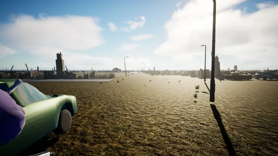
World Partition streaming lets the map keep growing without one enormous level. Instanced meshes let about 767,000 pieces of dressing sit across the map, with a lighter set on the low graphics setting so ordinary PCs can keep up.
The same tools that build Doncaster from map data could, in the long term, build other places, or have uses beyond this game.
Long-Term Vision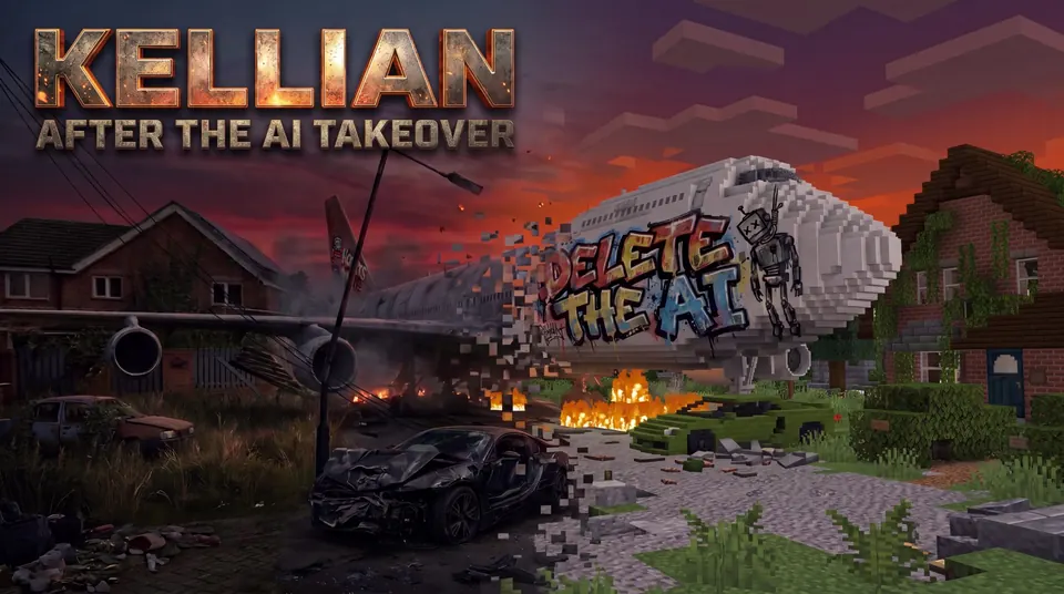
04 / KEY ART
This is the artwork on the game's title screen: the real, ruined street turning into blocks, the game's two realities in one picture. It's artwork rather than a capture from the game, so it lives here and on the home page, and not in the screenshot gallery. Real block builds from the game are in the screenshots.
The jet and its graffiti are in the game itself: see Headingley Close in the screenshots.
05 / THE AMBITION
The aim is to let people experience a place they know in a completely different way: surviving it first, then rebuilding it together, and watching it change over months and years.
The project is self-funded. The first focus is simple: build a game people enjoy, and a community of players around it.
06 / CREDITS
Made with Unreal Engine 5. Unreal and Unreal Engine are trademarks or registered trademarks of Epic Games, Inc.
The game is set in a fictional future of a real town. Shops, brands and businesses that appear in the world are scenery: they don't imply any partnership, sponsorship or endorsement.